Burkittsville
Historic structures, streetscapes, and other scenes from around the village.
|
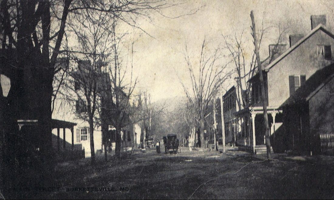
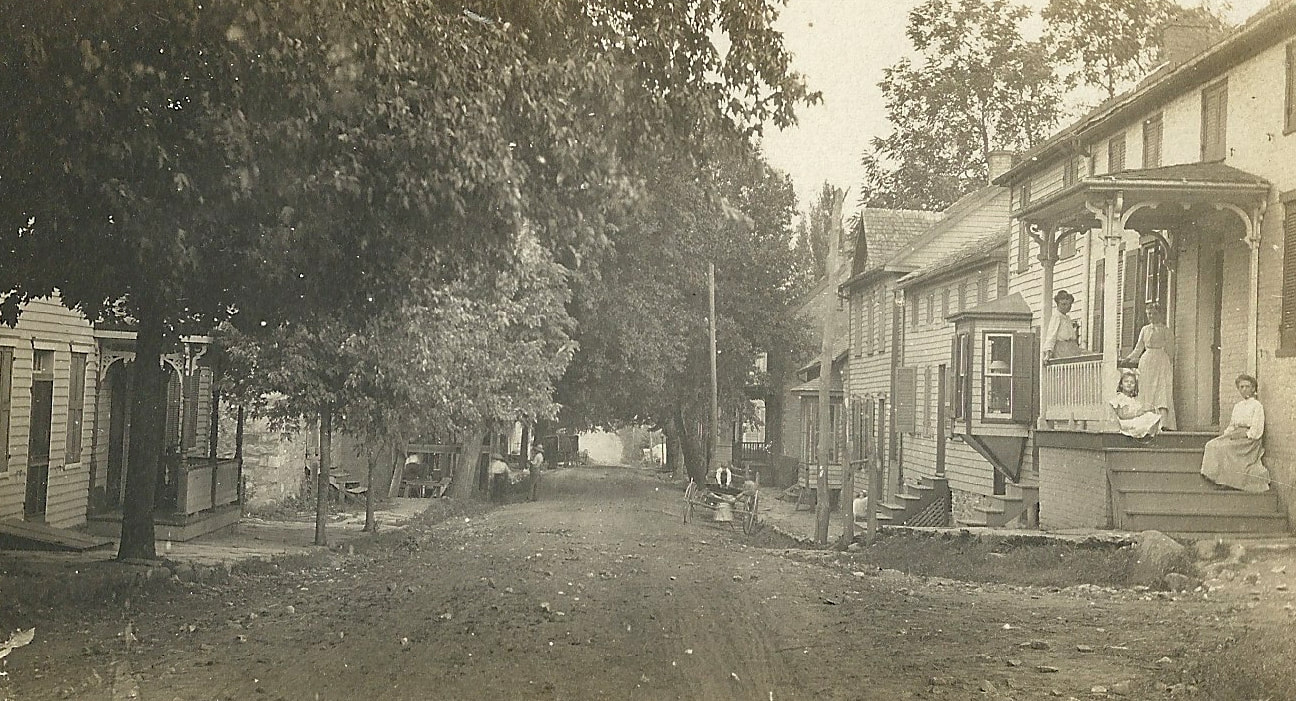
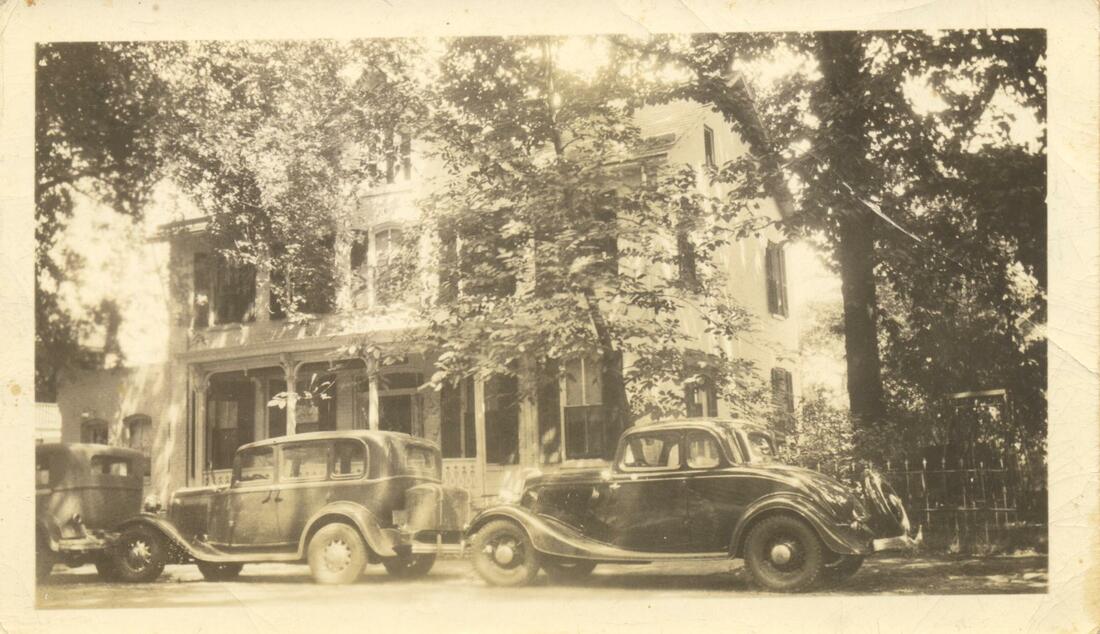
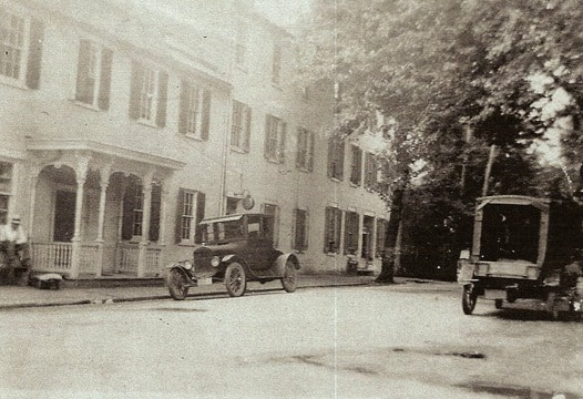
One of the earliest-known photographs of Burkittsville, a real-photo postcard showing the town square looking west towards South Mountain. The second building from the left is the historic Harley Store (also home to Grove's, Horine's, Gordon's, and now P.J. Gilligan's General Stores). Across the street is the Hightman/Huffer/Guyton Store. The house and smaller building to the right are the Rev. Emanuel Slifer House and Tailor Shop. From the museum collection.
|
|
|
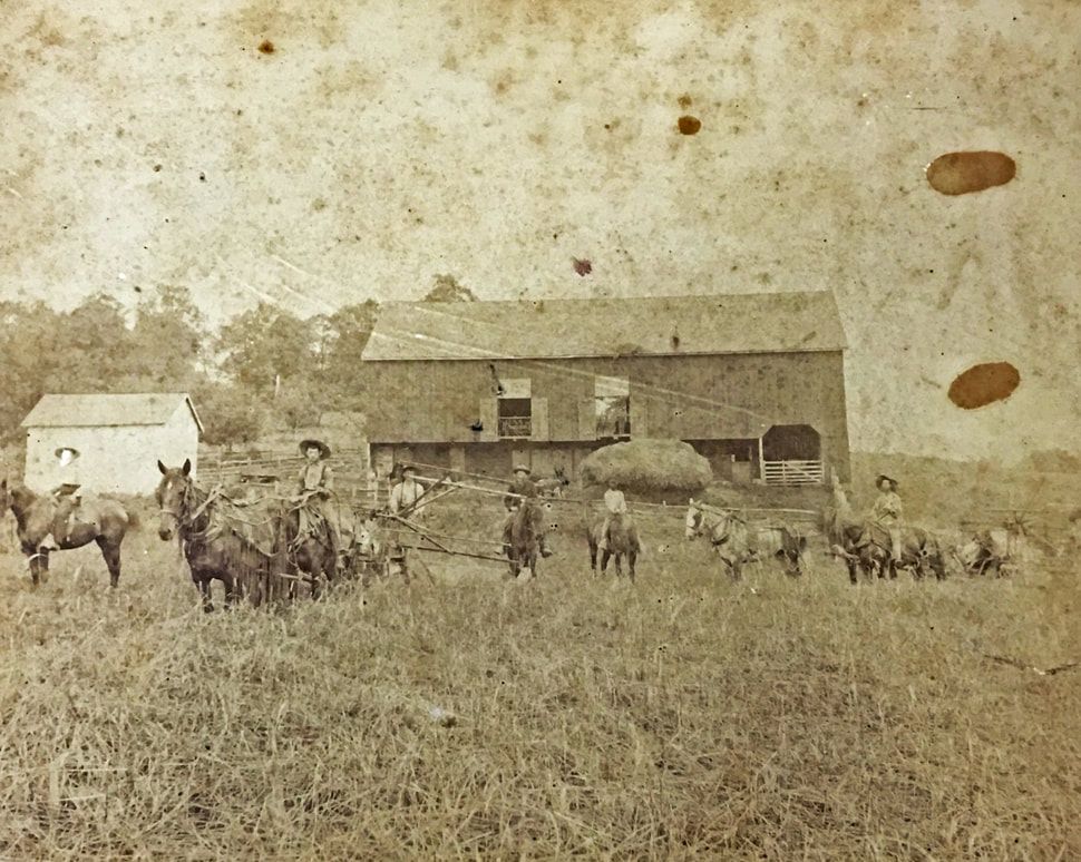
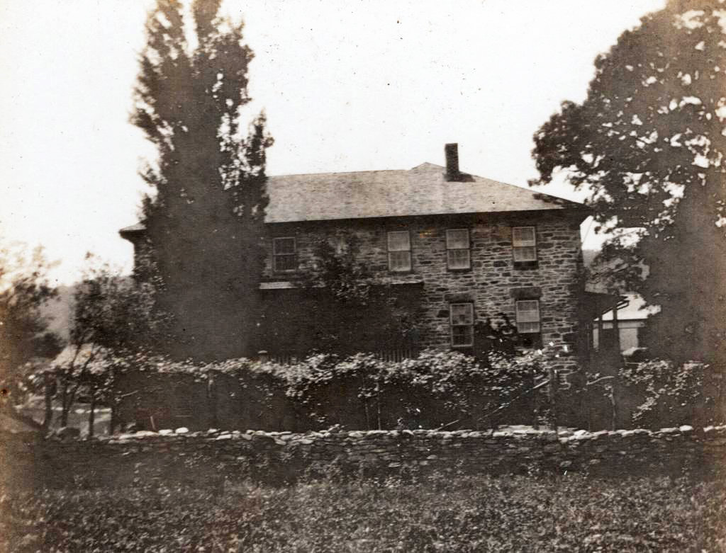
The house and barn of "Friends Goodwill," also known as the Henry Burkitt Farm or the Guyton Farm. Photographs contributed by Rick and Denise (Guyton) Boyer.
|
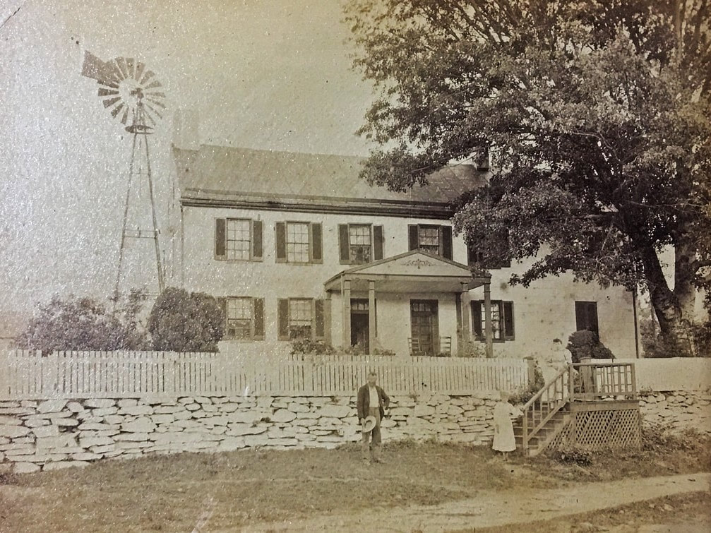
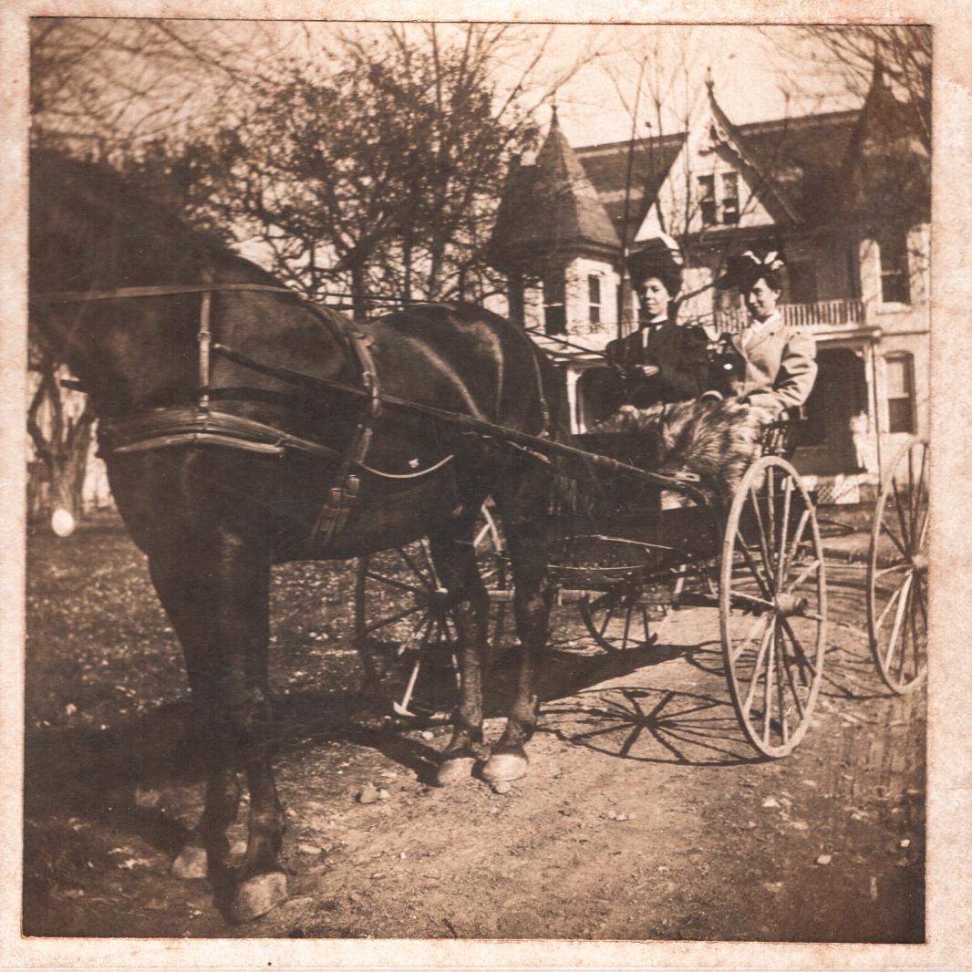
The Otho Harley Farm is better known today as Distillery Lane Ciderworks. The grandson of Burkittsville founder Joshua Harley, Otho Harley purchased this farm from the Willard Family in the early-1830s. The Reformed Church held its first services in the barn of this estate beginning in the mid-1820s. The original farm house burned and was replaced by this Queen Anne house around 1899. The women in the carriage are likely members of the Arnold or Harley family which were related through marriage. Since 2001, the Miller Family has operated Distillery Lane Ciderworks on this historic property. Photograph from the Charles Graham Arnold Collection.
|
|
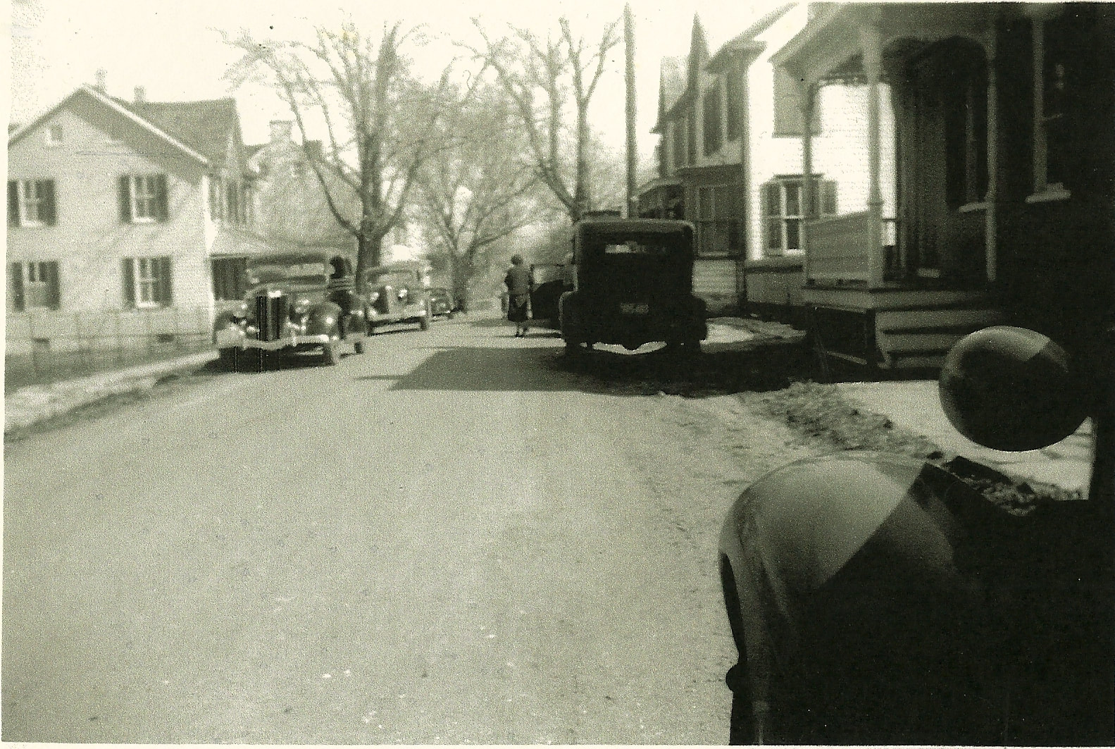
A view of Main Street from the Lutheran Parsonage. The Guyton Store is visible in the center of the photograph and the Emanuel Slifer House is seen to the right. From the Zirkle Collection, donated by Georgia Ann Zirkle.
|
|
|
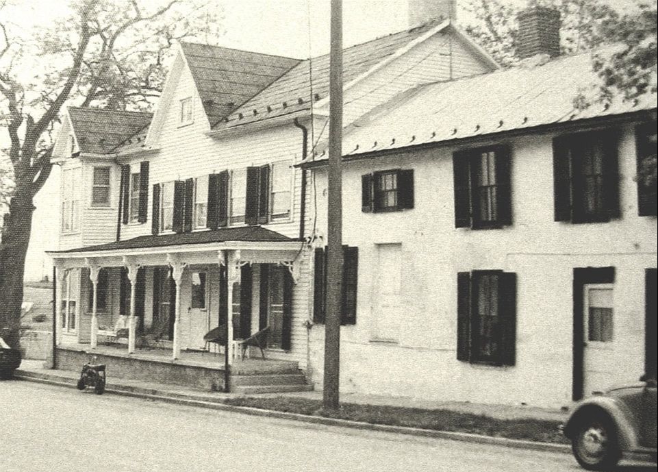
The Barger House, located at 301 East Main Street, seen in the 1940s. Like many of the historic houses in Burkittsville, the Barger House is an early brick structure representing a transition from Federal to Greek Revival styles with a later Victorian-period porch added to "modernize" the house. Note the brick sidewalk, lined with paving stones to form a gutter along the street side. From the Barger Collection, donated by Kirby Barger.
|
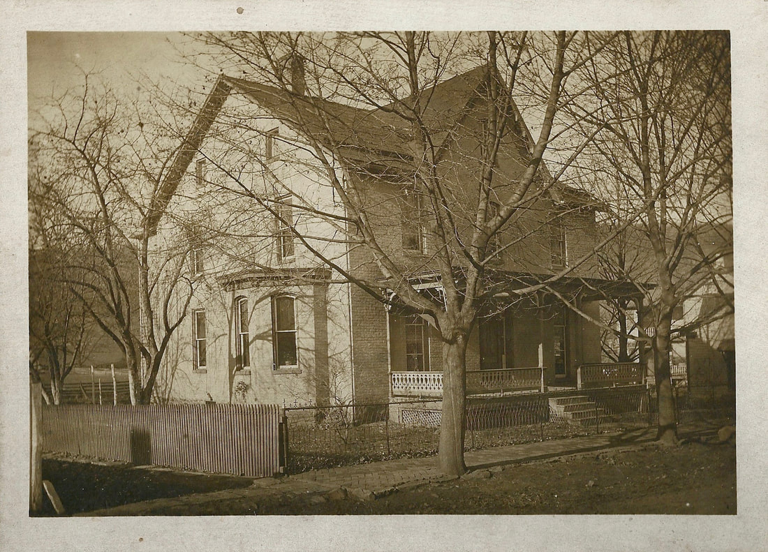
A historic view of the David Arnold House, also known as "Gaver's Recovery," the farm that anchors the west side of Burkittsville at the base of South Mountain. The farm occupies land from the original 1741 tract entitled "Dawson's Purchase," the first land tract patented within the present boundaries of the town. The earliest portion of the stone farm house was built in the late-18th century. David Arnold erected the large extension of the house, which is seen in this photograph. Photograph from an Arnold Family genealogical pamphlet, contributed by Paul J. Gilligan.
|
Another view of the David Arnold House, likely from the early-twentieth century. The Arnold Family lived on the farm until the passing of sisters Laura Bernadette and Editha Anne Arnold in 1968 and 1969 respectively. The large bank barn that stands on the western, up-hill side of the house can be spotted between the front porch and the massive tree that until recently stood in the front yard. Photograph from the Charles Graham Arnold Collection.
|
|
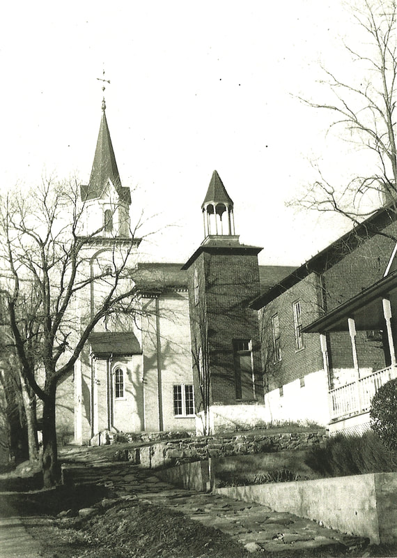
This circa-1900 photograph of the Resurrection Reformed Church offers a view of the building shortly after the renovations that took place in 1896. The Stick-style Victorian belfry, containing a 700-pound bell cast in Baltimore, rises above the older Greek Revival portico, a product of the 1860 rebuilding of the church. While these elements survive today, the wrought iron fence, gate, and lamp post in the front of the churchyard sadly do not (they were likely sold for scrap metal during World War II). From the museum collection.
|
|
|
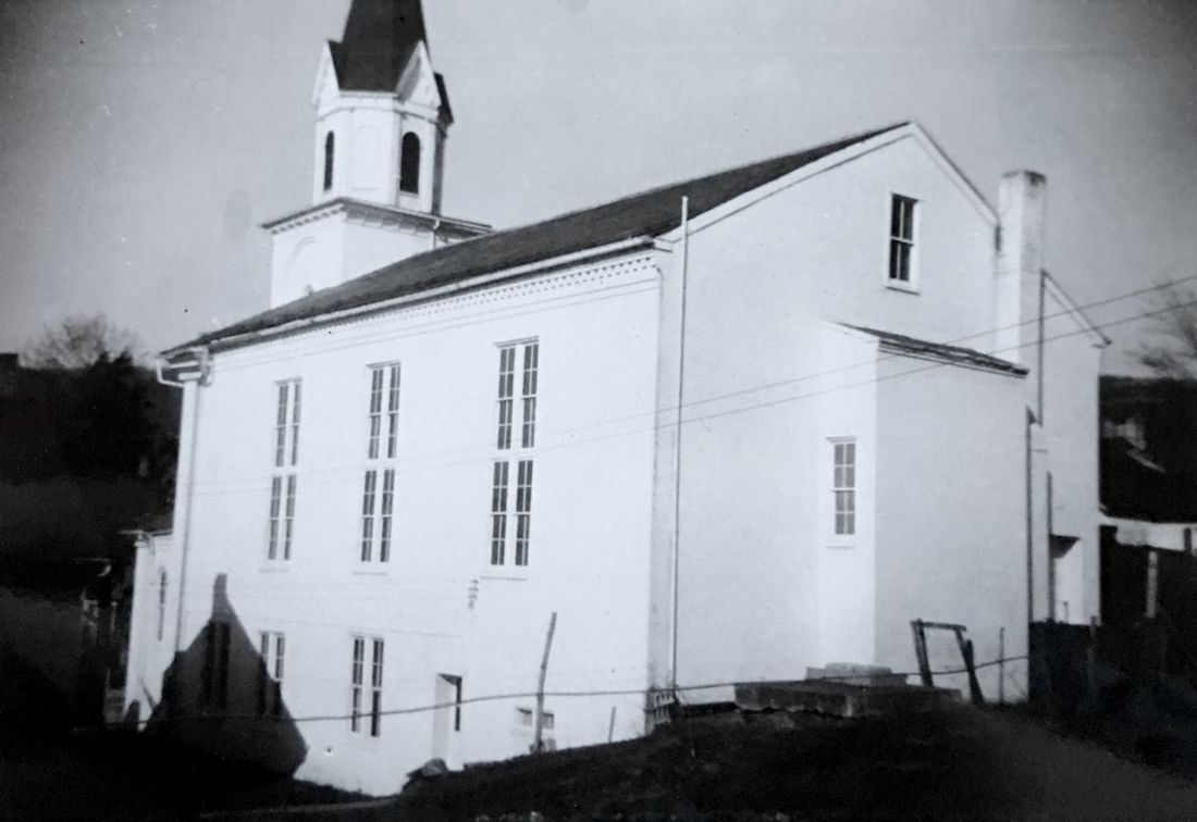
In 1979, after a century and a half of active use as a place of worship, Resurrection Reformed Church held its last service at Thanksgiving, captured in this photograph by the Frederick Post newspaper. The building was already being recognized for its historical significance by the time the congregation disbanded and the church was immediately assumed by the Burkittsville District Heritage Society. Despite the early efforts to preserve the church, the building languished unused for nearly twenty years until the South Mountain Heritage Society secured grants to fully preserve the historic building. Today, the church continues to be a place for community gatherings and the heritage society's museum introduces Burkittsville's unique history to hundreds of visitors each year. From the museum collection.
|
|
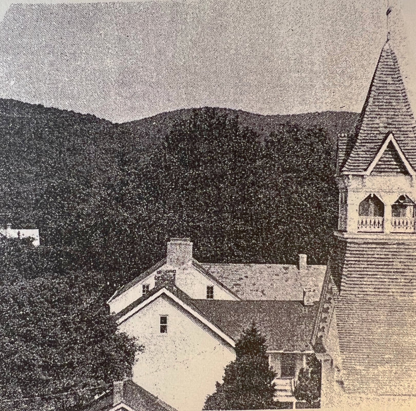
This circa 1950 photograph was taken from the spire of Saint Paul's Lutheran Church and looks west towards South Mountain. Crampton's Gap, the scene of fighting during the Battle of South Mountain on September 14, 1862, can be clearly seen in the background. The steeple of Resurrection Reformed Church is visible on the right and beneath it are the Emmanuel Slifer House and the Guyton Store and House, between which Route 17 enters from the north to cross Main Street at the town square. From the museum collection.
|
|
|
This wonderful scene of East Main Street in the 1940s offers a glimpse of town as automobiles became more common among the residents. The second building from the right with the bay window was historically the sight of a tavern, operated by "Huff" Ahalt and later known as "Rosie's Place." The house on the left side of the street was home to DEVA, a cottage industry that produced clothing in Burkittsville in the 1980s and 90s. From the Barger Collection, donated by Kirby Barger.
|
This photograph shows two historic buildings located near the center of town. The house on the left is the Dr. Tilghman Biser House, an early-19th century log structure later expanded and decorated in Queen Anne style. Dr. Biser was one of Burkittsville's first resident physicians. The building on the right is one of several buildings in town that was built to serve both as a residence and as a commercial enterprise. The door on the right would be the main entrance for the residence, while the door on the left, set above the street and originally reached by wooden steps, entered the storeroom. One of the business known to operate here was the tin shop of George Padget. From the museum collection.
|
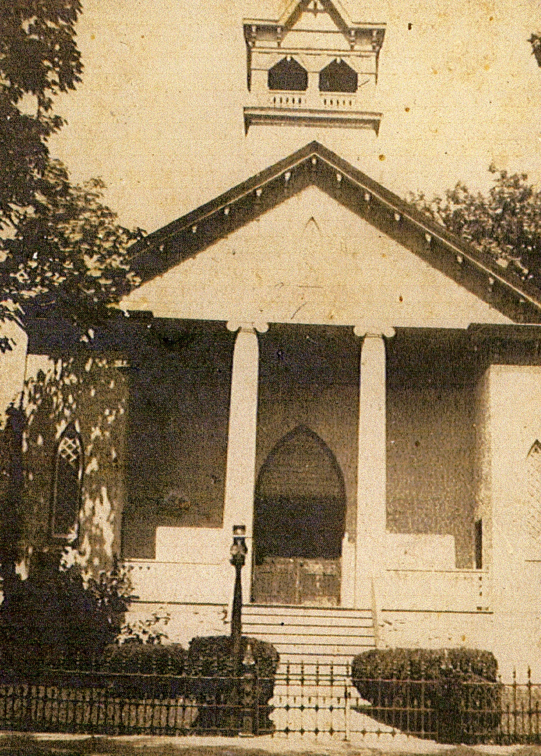
St. Paul's Church was built in 1859 when after thirty years of sharing the Union Church with the German Reformed congregation, the Lutherans of Burkittsville determined to build their own house of worship. When the church was constructed, a school house was also built on the east side of the church. Originally operated as a private academy, the schoolhouse was subsumed into the Frederick County Public Schools system in the 1870s and served as the town's elementary school until 1914. Afterwards, the building was returned to the church and has been used as a parish hall ever since. St. Paul's Church was renovated in the 1870s when the bell tower and spire, seen in this photograph, were added to the front of the original building. This photograph shows the old flagstone sidewalks that were once common throughout the town. From the Barger Collection, donated by Kirby Barger.
|
|
In 1955, St. Paul's Lutheran Church expanded its building with a two-story Sunday School annex erected on the back of the 1859 church. Taken a year before construction began, this 1954 photograph shows how St. Paul's Church appeared before the addition was completed.
Photograph from the Zirkle Collection, donated by Georgia Ann Zirkle. |
|
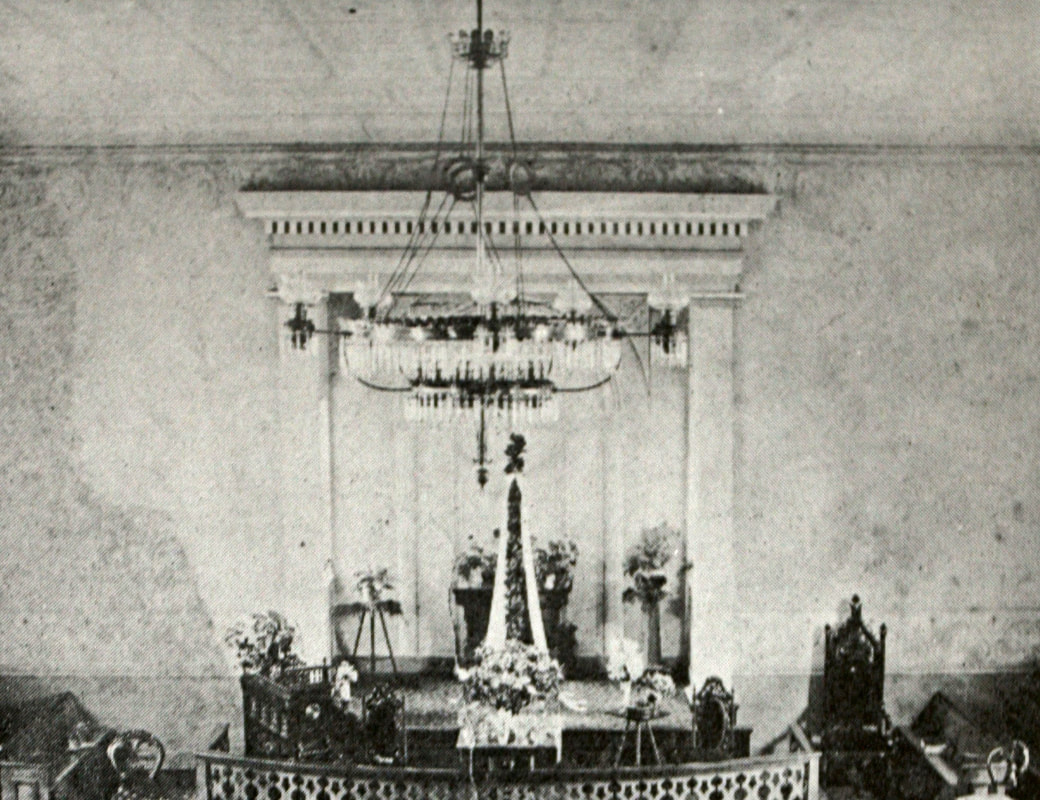
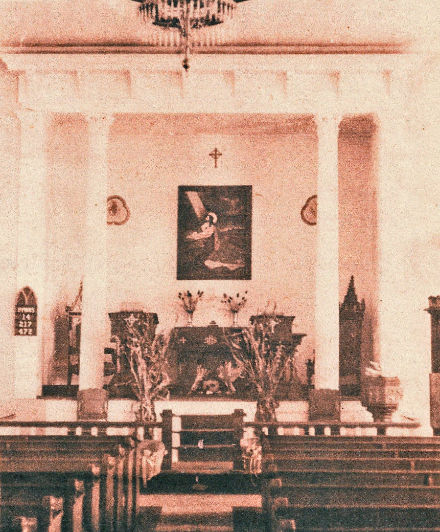
This late-19th century view of St. Paul's Lutheran Church captures the interior of the sanctuary prior to major renovations that were conducted in 1914/15. While many features of this interior no longer exist, such as the chandelier and the curved chancel rail, others do, including the cornice over the altar and some of the furnishings in the pulpit area. Photograph donated by St. Paul's Lutheran Church.
|
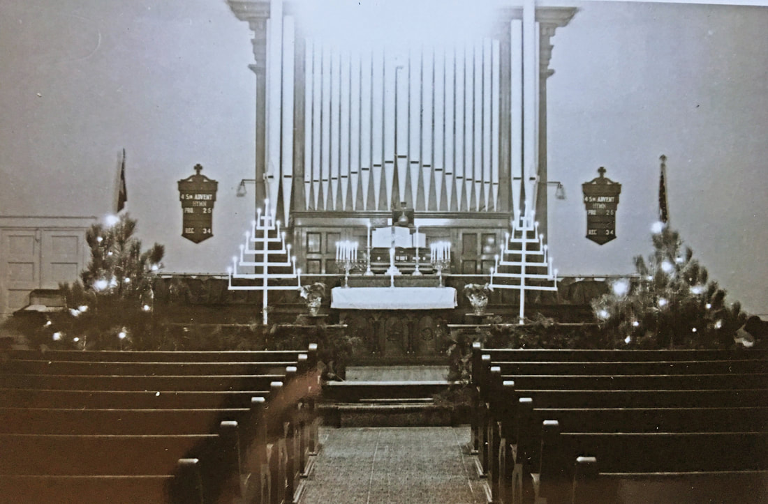
In 1914, St. Paul's Lutheran Church was renovated, including the addition of a Moller Pipe Organ, seen in this 1950s photograph taken around Christmas. The sanctuary was again remodeled in 1964 to its present Colonial Revival appearance, the pipe organ moved to a chamber built above the altar. Photograph from the Zirkle Collection, donated by Georgia Ann Zirkle.
|
|
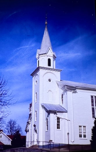
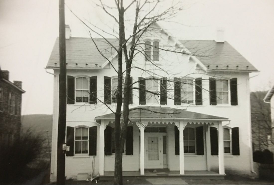
This image was captured in the 1970s and shows Saint Paul's Lutheran Church when it was still painted white. Many of Burkittsville's brick houses, stores, and other public buildings, have historically been painted. The clay used in producing bricks locally resulted in the finished product being soft and porous, especially susceptible to water damage. In order to seal the bricks, paint was applied. In the 1990s, Saint Paul's removed its paint to reveal the original brick which is a light red/orange color. Photograph from the Zirkle Collection, donated by Georgia Ann Zirkle.
|
|
|
The Pfiefer Family was one of many in Burkittsville that resided and operated a commercial enterprise within their dwelling in the 19th century. Casper Pfiefer, a cobbler, operated his shop in the frame structure seen in the center of this photograph and lived in the brick dwelling attached on the right. From the museum collection.
|
This circa-1910 photograph of East Main Street shows the dramatic tree-cover that once shaded Main Street throughout town. The first building on the right is the resident and cobblers shop of Casper Pfiefer. The stone building, barely visible as the second structure from the left, was known as the "Union Chapel," built in the mid-19th century as a Methodist Episcopal Church but later used as a meeting hall for town organizations, including the Junior Order of United American Mechanics (J.O.U.A.M.). The building was dismantled in the 1960s and is now the site of a parking lot. From the museum collection.
|
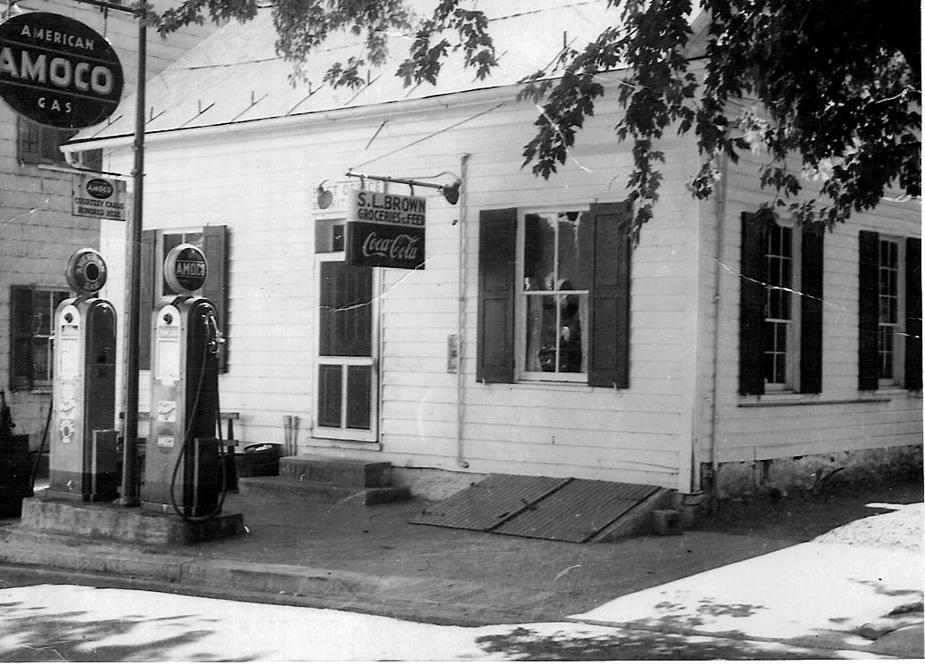
Today, this landmark of Burkittsville is known to residents as the Post Office, but it has housed many commercial enterprises over its history. The first known business on this site was a cabinet shop owned by the Karn Family. In the early-20th century, the building became a general store, operated successively by Irving McGaha, Samuel Luther Brown, Sr., and George Karn, Jr. Photograph donated by Sam and Joyce Brown.
|
|
In the nineteenth century, Burkittsville's Lutheran and Reformed Churches each employed a Sexton, or caretaker who was responsible for tasks including keeping the church stoves lit, cleaning the sanctuary, digging graves, and ringing the church bells. This house was the dwelling for the Lutheran Sexton and his family and stood immediately behind St. Paul's Church on the cemetery hill. The house was taken down in 1954 to make way for the church's Sunday School Annex. From the Zirkle Collection, donated by Georgia Ann Zirkle.
|
|
|
The Parsonage of Resurrection Reformed Church was built in the 1850s and stood adjacent to the church on the east side. Over a dozen pastors and their families lived in this house over ninety years until the late-1940s when Resurrection Church ceased to be a fully-independent charge (or parish) and was placed under pastoral care of Christ Reformed Church in Middletown. Thereafter, ministers of Christ Church traveled to Burkittsville to conduct services and the parsonage was no longer needed. The church sold the parsonage and in 1968 the building was demolished to make way for a parking lot between the Reformed and Lutheran Churches. St. Paul's Lutheran Church is visible to the right side of the parsonage. Photograph donated by Sam and Joyce Brown.
|
This elegant Italianate styled house at 3 West Main Street was the home of Dr. George Wilmer Yourtee in the early-20th century. Dr. Yourtee saw his patients in the small office seen in this photograph attached to the left side of the house. Photograph donated by Robert and Maurine Young.
|
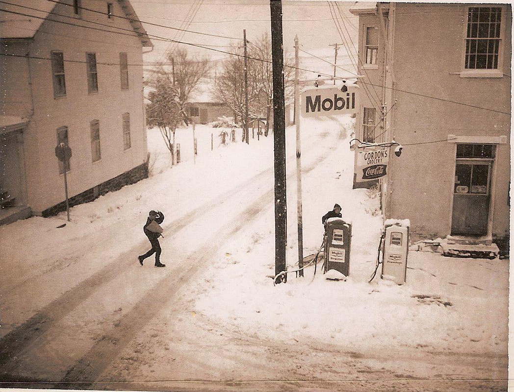
A wintery scene outside Gordon's General Store in Burkittsville. From the 1920s until the late-1970s, three general stores operated in Burkittsville, each selling groceries, hardware, work clothing, housewares, and gasoline. Gordon's Store, located in the town's oldest commercial building, closed in the early-1970s. Today, this building has been preserved and operates at the P.J. Gilligan Mercantile, a mid-19th century period general store. From the museum collection.
|
|
The Pfiefer Family poses outside their home located at 205 East Main Street. Like so many homes in the village, the Pfiefer/McBride House is made of elements constructed at various times. The rear ell wing is likely the oldest part of the structure, built of stone. The front potion, with its Queen Anne-styled porches, was added in the late-19th century. The Pfiefer/McBride House is one of several in Burkittsville to preserve its original carriage house, seen at the right of the house. Photograph donated by Sam and Joyce Brown.
|
|
|
Garland Guyton owned and operated this general store from the 1930s until it closed in the late-1970s. Prior to Guyton's proprietorship, the store was owned by the Hightman and later Huffer families. From the museum collection.
|
The Victorian character of the Graham House is indicative of the prosperous era enjoyed by Burkittsville in the last quarter of the 19th century. Local industry fueled by the two rye whiskey distilleries and the tannery operating around the village helped to rebuild the economy after the Civil War and led to the construction of many new buildings in the town sporting popular styles of the Victorian Age. When the Baltimore & Ohio Railroad opened their Washington County Branch line in the 1870s, Burkittsville gained access to the railroad at Gapland Station, two miles to the west over South Mountain. This connection allowed for easier and cheaper importation of mass produced architectural details such as decorative millwork or “gingerbread” and windows with larger and sometimes specially-shaped panes of glass, such as those seen in the Graham House. The Graham House, constructed in the mid-1880s, blends elements of Queen Anne, Gothic Revival, and Italianate architecture. Photograph donated by Jody Brumage.
|
The Parsonage of St. Paul's Lutheran Church was built in the mid-1870s in the popular Italianate style. Houses such as this, with pre-milled brackets, verge boards, and large, round-arched windows, were made possible by the arrival of the railroad after the Civil War. The Baltimore & Ohio Railroad operated a branch line through Pleasant Valley, which brought rail access as close as two miles to Burkittsville. From the Zirkle Collection, donated by Georgia Ann Zirkle.
|
|
|
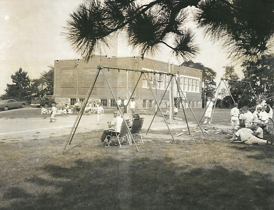
A little league ballgame in process at the Burkittsville Elementary School in the 1960s. Since its construction in 1914, this building has been at the center of community life in Burkittsville. When Valley Elementary School in Jefferson was opened in 1968, Burkittsville's school was closed. The building was then purchased by the Ruritan Club and has since been the scene of countless community meetings, social events, and the annual summer carnival. Photograph donated by Samuel and Janice Crone.
|
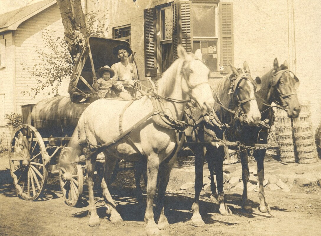
This wonderful scene captures John W. "Coal Oil Johnny" Mentzer and his son, Peter J. Mentzer, on their delivery wagon in Burkittsville. Coal Oil was a predecessor to Kerosene, used for illumination, and remained a term of choice even after petroleum-derived Kerosene became the main lighting fuel. Photograph donated by Susan Mentzer Blair.
|
This early-twentieth century view of West Main Street from the square shows Horine's Store on the left followed by the three-story Seminary Building. Constructed in the late-1860s, the Seminary was an institution of higher education for women, operated under the auspices of the clergy of St. Paul's Lutheran Church. Students boarded at the school which offered a four-year program. Many graduates of the seminary became educators. After the school's closure in the mid-1880s, the building has been used as a boarding house and is now apartments. From the museum collection.
|
|
|
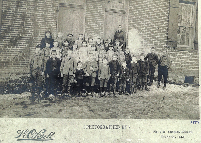
Students and their teach pose for a portrait outside the Burkittsville Elementary School in 1897. Among the educators who taught in the old elementary school was Mollie Hightman, a graduate of Burkittsville's Lutheran Female Seminary. Photograph donated by Sam and Joyce Brown.
|
|
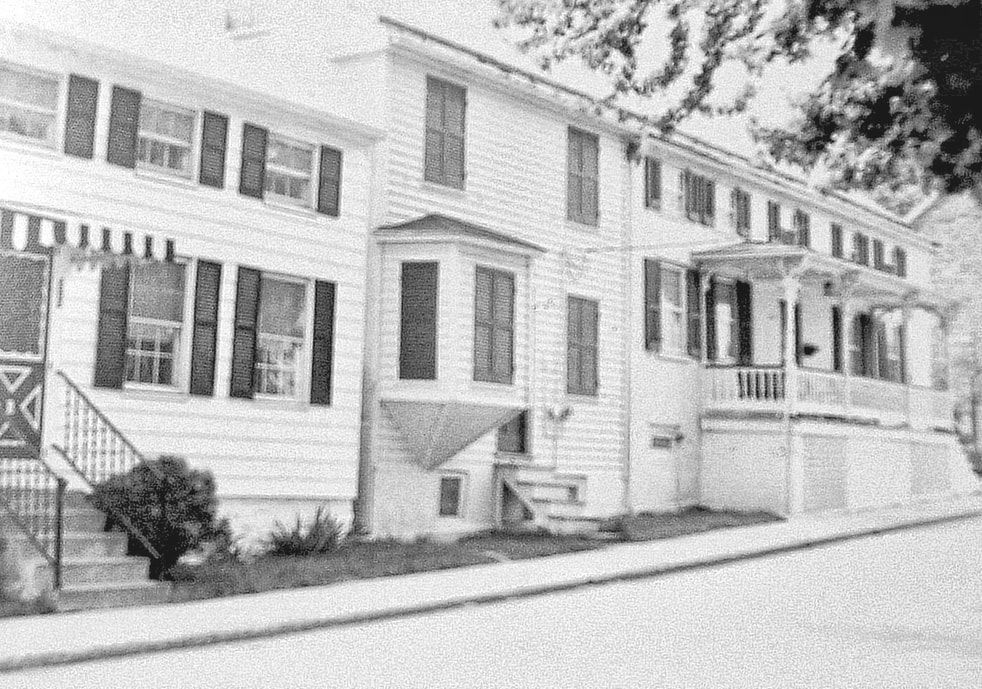
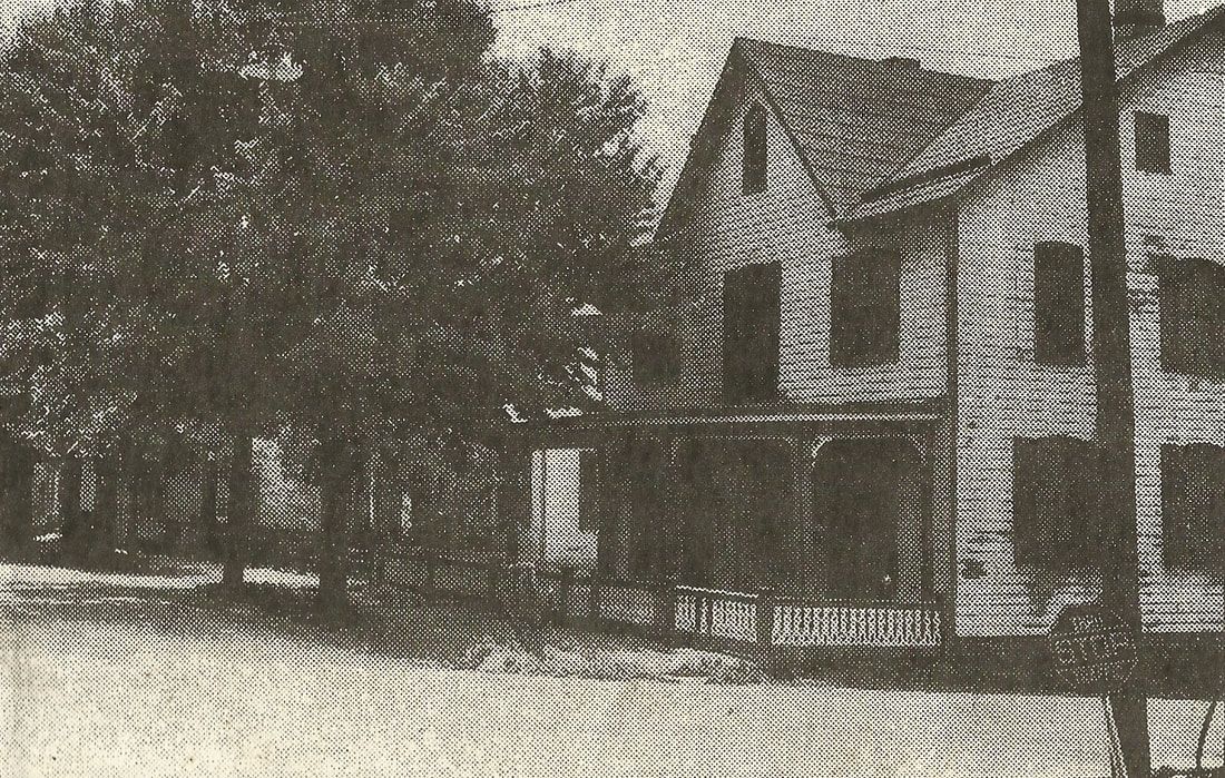
This streetscape, captured in 1941, shows 2 East Main Street, a charming Queen Anne structure. The Parsonage of St. Paul's Lutheran Church stands adjacent to the left, obscured by the large trees that shaded the street. Close inspection of the top left corner of the photograph reveals a gas street lamp that was suspended over the square. From the museum collection.
|
|
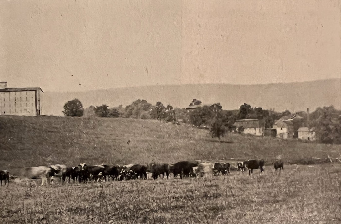
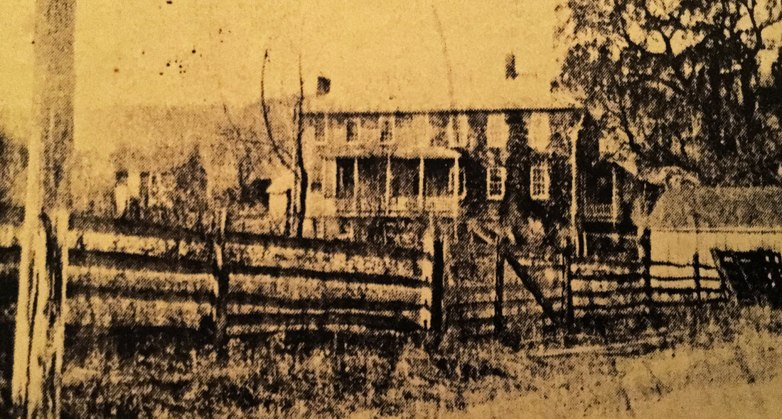
The Mountain Spring Distilling Company, better known as "Ahalt's Distillery," was one of two rye whiskey distilleries that operated in Burkittsville in the late-19th and early-20th centuries (the other was Horsey Distillery). John D. Ahalt established the Mountain Spring company in 1876 and converted a former mill, located in the cluster of buildings seen at the right side of the photograph, to house the distilling equipment. As the business grew, a five-story barrel warehouse was constructed on the hill overlooking the distillery complex, seen at the left of this photograph. Ahalt's signature whiskey was marked as "The Antietam" and was sold in markets throughout the east coast. From the museum collection.
|
Rev. Emanuel Slifer, pastor of Pleasant View Church of the Brethren, erected this brick building adjacent to his home on the square in Burkittsville around 1845 to house his tailors shop. After Rev. Slifer's death, the property sold to Otho S. Highbarger, who operated a clock and jewelry store in this building. In the 20th century, subsequent owners used the picturesque building as an attorneys office and as a barber shop, the function it served when this photograph was taken. From the museum collection.
|
|
In the early-20th century, John R. Roelke owned this house and storeroom in east Burkittsville where he operated a funeral home. The structure still stands today, though much altered and converted into apartments. From the museum collection.
|

|
|
This 1970s photograph of the Roelke House offers a record of many details which have been lost to modern renovations of this structure. On the left beneath the gable, the storefront where Roelke's funeral home was located was still visible. Original six-over-six windows in the left portion of the house and visible butt joint suggest that this was the oldest section of the overall structure. This is also attested by the charming Federal-styled wing attached at the rear of the house with its dormers and porch. Photograph donated by Bob and Maurine Young.
|
|
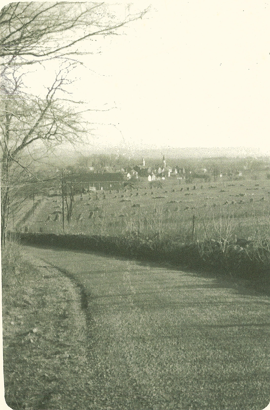
This view of Burkittsville from South Mountain captures the landscape which still characterizes the historic agricultural heritage of the town. The farm seen to the right side of Gapland Road is the David Arnold Farm. The fields above the barn are lined with stands of corn freshly cut. Beyond the farm, the spires of Resurrection Reformed Church (left) and St. Paul's Lutheran Church (right) are visible. From the Barger Collection, donated by Kirby Barger.
|
|
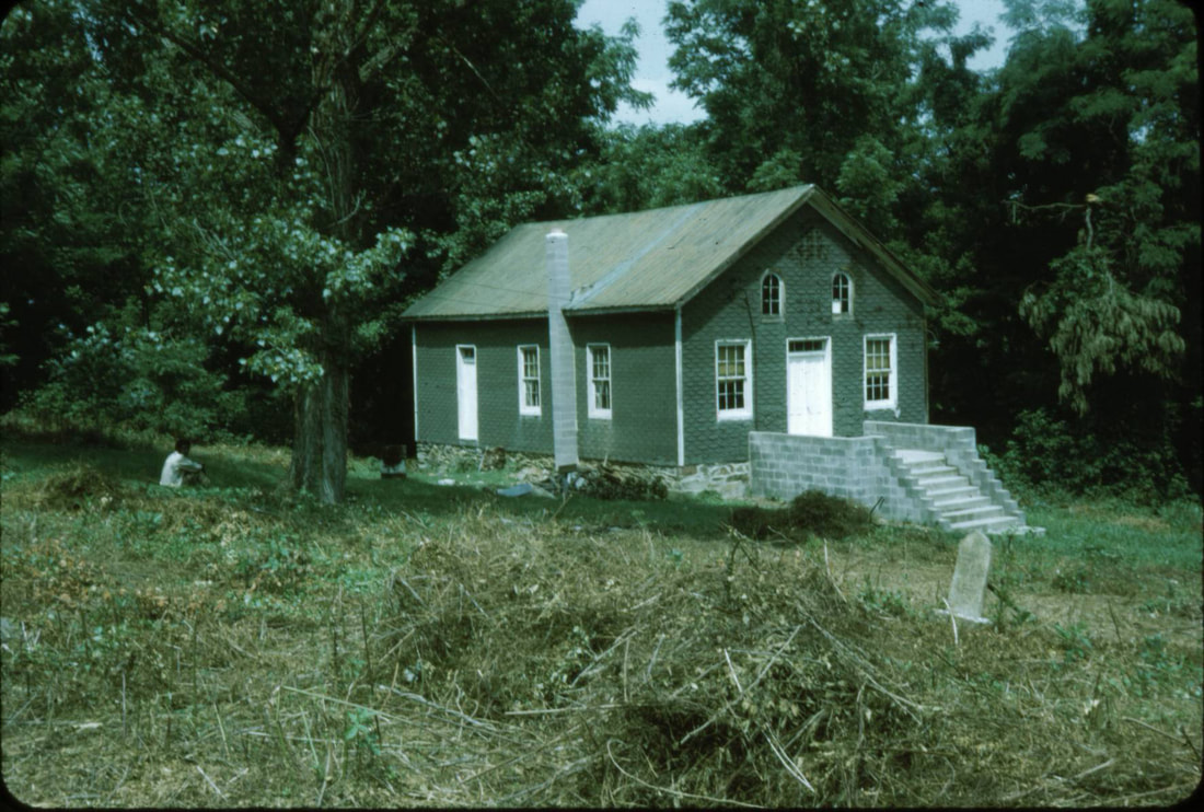
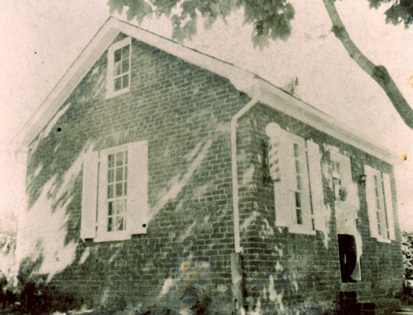
Ceres Bethel African Methodist Episcopal Church is captured on a summer afternoon in 1975. The frame church, located by the side of Gapland Road as it climbs out of town up to Crampton's Gap, was built in 1870 on the site of an earlier church and schoolhouse which served the small African American settlement that existed along the mountain side. Ceres Bethel Church was founded by Rev. Thomas Henry, a prolific circuit riding preacher of the AME Church who visited the Middletown Valley in the 1850s, organizing congregations in Middletown, Knoxville, Petersville, and Brunswick, in addition to Burkittsville. Since the church's closure in the late-1980s, Ceres Bethel Church has suffered from vandalism and neglect. From the museum collection.
|
|
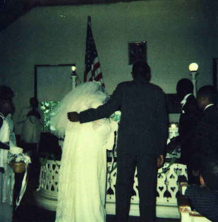
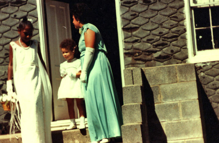
These photographs from a wedding in 1984 capture Ceres Bethel African Methodist Episcopal Church in its final years before the congregation disbanded. Visible features of the church's interior include an intricately-carved chancel rail and two lamp stands on the pulpit dias. From the museum collection.
|
In the 19th century, East Main Street in Burkittsville was a flourishing collection of cottage industries, including blacksmiths, wheelwrights, and a tinsmith. The tin shop was located in this building, another composite residential and commercial structure. In later years, a general store operated in this building before it was subdivided into apartments. From the museum collection.
|
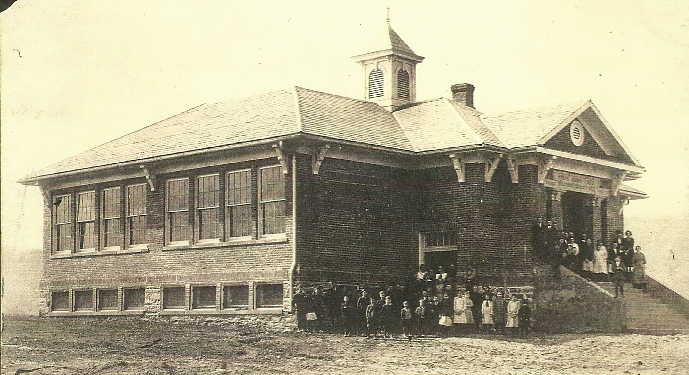
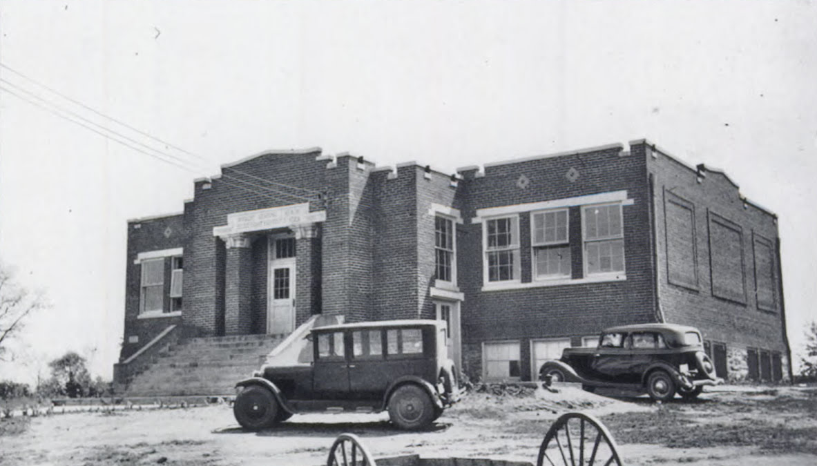
In 1914, after years of campaigning by town residents, a new school was built in Burkittsville. The brick structure housed three classrooms and a auditorium on the main floor (the latter was eventually converted to a cafeteria). Below, two gymnasiums were built, one for girls and the other for boys. The building as seen in this photograph only existed for four years. A fire gutted the still-new school in 1918, leaving just the brick walls standing. From the museum collection.
|
When Burkittsville Elementary School was rebuilt after the 1918 fire, the decorative hipped roof, bracketed cornices, and cupola were not restored. A flat roof was built over the school and decorative brick parapets added to the tops of the brick walls. After the school closed in 1968, the building was purchased by the Burkittsville Ruritan Club which continues to meet in it today.
From the Frederick County Historical Society. |
|
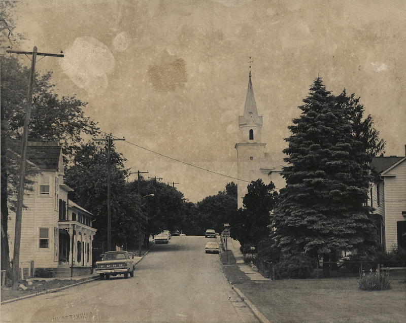
Main Street ascends the hill towards the town square in this 1970s photograph. The house on the left is the Dr. Tilghman Biser House. Across the street, the Dr. John E. Garrott house is visible behind the pine tree. The steeple of St. Paul's Lutheran Church rises near the center of the photograph. From the museum collection.